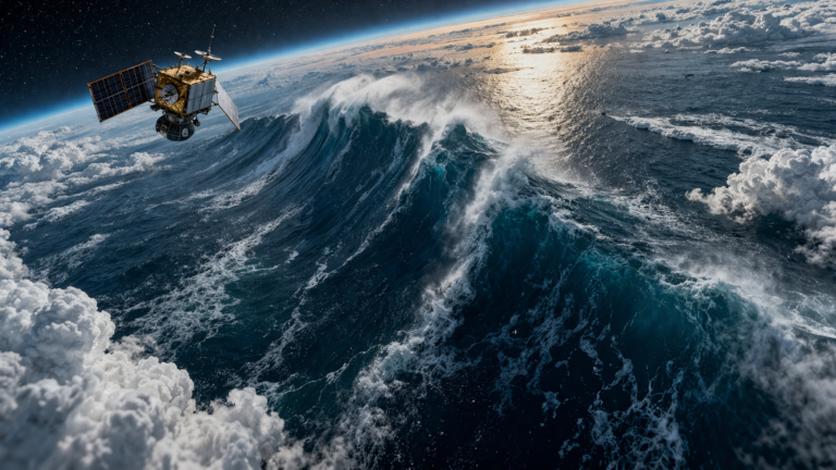
Satellites detect titanic 35-metre waves in the middle of the Pacific — a startling reminder of how powerful the ocean can be and how far remote sensing has come. In recent observations, spaceborne instruments recorded exceptionally large wave heights in a remote part of the North Pacific, providing scientists with new data on extreme sea states that are difficult to capture from buoys or ships.
How satellites measure huge ocean waves
Satellites use several complementary techniques to estimate wave height and sea state:
- Radar altimeters: Instruments like those on the Sentinel-3 and Jason series send radar pulses to the sea surface and measure the return waveform. The shape of that waveform gives an estimate of significant wave height (the average height of the highest one-third of waves).
- Synthetic Aperture Radar (SAR): SAR imagery (e.g., Sentinel-1) can resolve wave patterns over large swaths, revealing wavelength, direction, and, with advanced processing, estimates of amplitude and energy.
- Scatterometers and radiometers: These sensors measure surface winds and roughness, which help infer wave growth and validate wave models.
- Multi-satellite cross-checks: Multiple passes and different sensor types reduce uncertainty and confirm that extreme readings are real and not instrument artifacts.
It’s important to note the distinction between significant wave height and a single freak wave. A satellite-reported 35-metre value usually refers to significant wave height — an average measure of the most energetic waves — which implies that some individual waves could be even taller.
What causes 35-metre waves?
Several factors can combine to produce truly giant waves:
- Intense, long-lasting storms: Strong extratropical cyclones or powerful tropical systems generate sustained winds over long fetches, allowing waves to grow.
- Long fetch and duration: The farther and longer the wind blows over open water, the bigger the waves can become.
- Wave superposition: Different wave trains can align (constructive interference), producing occasional extreme peaks.
- Ocean currents and bathymetry: Interaction with powerful currents (for example, the Kuroshio) or abrupt changes in seafloor topography can focus wave energy and amplify heights.
- Climate variability: Large-scale patterns such as ENSO or a changing storm track can affect the frequency and intensity of extreme wave events.
In the open North Pacific, where storms regularly sweep across thousands of kilometers of ocean, the ingredients for very large waves are often present.
Why these satellite detections matter
- Safety for mariners and offshore operations: Extreme waves pose direct hazards to ships, oil platforms, and fishing fleets. Satellite data improves situational awareness in remote regions beyond the reach of buoys.
- Model validation and forecasting: Observations of exceptional wave events help test and improve wave models (e.g., WaveWatch III), leading to better forecasts and warnings.
- Scientific insight: Measuring the statistics and mechanisms of extreme sea states refines our understanding of ocean dynamics and wave physics.
- Climate monitoring: Long-term satellite records reveal trends in storminess and wave climates, which is important for coastal planning and infrastructure resilience.
Verification and context
Extreme satellite readings are usually cross-checked against other platforms and model output. When multiple satellites observe the same event, or when a high-resolution model reproduces the signal, confidence increases. Historically, researchers have recorded similarly large significant wave heights in the Southern Ocean and parts of the North Atlantic during intense storms, though continuous global measurements are a relatively recent capability.
What’s next
Scientists will analyze the event in detail: time series of satellite passes, reanalysis of wind fields, and model simulations to reconstruct how the wave field evolved. These studies will help answer whether such events are becoming more common and how they might respond to future climate shifts.
Conclusion
The report that satellites detect titanic 35-metre waves in the middle of the Pacific highlights both the ocean’s raw power and the value of modern remote sensing. These observations are rare but vital — they improve forecasting, inform maritime safety, and deepen scientific knowledge of extreme sea states. As satellite coverage and processing methods continue to advance, we’ll gain an ever-clearer picture of the extremes that the world’s oceans can deliver.