New commercial and government satellite imagery has given analysts an unprecedented look at Chinese military activity. The images are prompting concern among defense experts because they reveal changes not just in hardware, but in posture, scale, and the speed of infrastructure development. While satellite observations alone rarely tell the whole story, the patterns emerging from months of imagery are enough to shift strategic calculations.
What the imagery shows
Satellites have captured a range of developments across multiple domains:
- Rapid construction and expansion of coastal and inland military facilities.
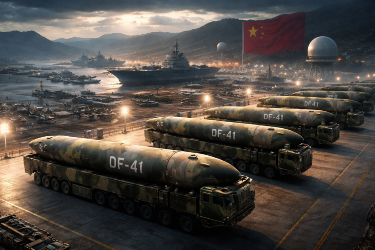
- Large-scale movement and dispersal of missile-related equipment and hardened structures.
- New test ranges and support facilities that suggest accelerated weapons testing programs.
- Expansion and modernization of naval support bases and logistical hubs.
- Increased activity around space and anti-satellite (ASAT) test sites, including launch-support infrastructure.
Many of these changes are visible in high-resolution optical imagery, while synthetic aperture radar (SAR) and multispectral sensors have confirmed infrastructure hardening, concealment measures, and the timing of construction. Night-light analysis and traffic flow patterns further reinforce the scale and tempo of activity.
Why experts are alarmed
Military analysts highlight several reasons the satellite observations are troubling:
- Strategic signaling: The scope and location of new facilities suggest a deliberate effort to project power and fortify strategic deterrents.
- Surprise potential: Rapid construction and dispersal complicate tracking and targeting, reducing decision time in a crisis.
- Regime of modernization: The variety of facilities — from missile silos to naval piers to space-related sites — signals comprehensive modernization rather than incremental upgrades.
- Escalation risks: Increased weapons testing and anti-access capabilities can heighten tensions in regional flashpoints and spark competing buildups.
Crucially, the imagery indicates not just more platforms, but also changes in how those platforms are operated — for example, greater emphasis on mobility, concealment, and redundancy. Those operational shifts are harder to counter and may require new surveillance and deterrence approaches.
What analysts are watching closely
Experts are focusing on several indicators that could clarify intent and capability:
- Patterns of construction over time, which suggest long-term programs versus temporary buildup.
- Integration of logistics and sustainment infrastructure that enable extended operations.
- Conspicuous movements of heavy equipment, which hint at testing cycles or redeployment.
- Development of shore-based support for longer-range naval operations.
- Signs of hardened or subterranean storage, which affect survivability.
These indicators help analysts estimate not only what China is building, but how it plans to use those assets in conflict or deterrence scenarios.
Limitations of satellite analysis
Satellites provide powerful insight, but they come with limits:
- Imagery captures snapshots, not always intent; interpreting purpose requires corroborating human intelligence and open-source reporting.
- Concealment and deception are possible — camouflaging, decoys, and controlled activity cycles can mask true capabilities.
- Some specialized facilities (e.g., cyber or electronic warfare hubs) are harder to identify from imagery alone.
Because of these limits, analysts treat satellite findings as one element of a broader intelligence picture rather than definitive proof of specific capabilities.
Implications for policy and defense
The imagery-driven revelations have prompted several policy and military responses:
- Increased investments in persistent ISR (intelligence, surveillance, reconnaissance) to maintain continuous observation.
- Accelerated development of countermeasures and resilient systems that can operate under contested conditions.
- Diplomatic outreach and military-to-military channels to reduce misperception and manage escalation risks.
- Renewed discussion about arms control frameworks that address emerging technologies and space-domain threats.
Decision-makers now face choices about balancing deterrence, transparency, and risk reduction in an environment where satellite monitoring makes surprises harder to conceal — but also makes rapid changes more visible.
Conclusion
Satellites flying over China have revealed a pattern of activity that many military experts find alarming: not necessarily because any single image shows a game-changing weapon, but because the aggregate picture points to rapid modernization, deeper integration of capabilities, and strategic intent to bolster power projection. The challenge for policymakers is to interpret these signals accurately, respond proportionally, and invest in the sensing, defenses, and diplomacy needed to manage a more contested regional and global security environment.